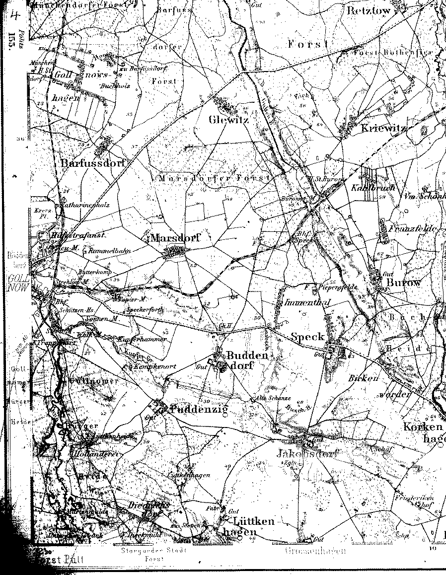
A detailed 1893 map showing part of the county of Naugard, Pomerania. [map covers an area of about 7 x 9 miles. Gollnow is just off the map, west of Marsdorf.]
From the Library of Congress collection of historic 1:100,000 scale topographic maps of Germany. Karte des Deutschen Reiches, Reichsamt fur Landesaufnahme, [Berlin.]
|
|
||