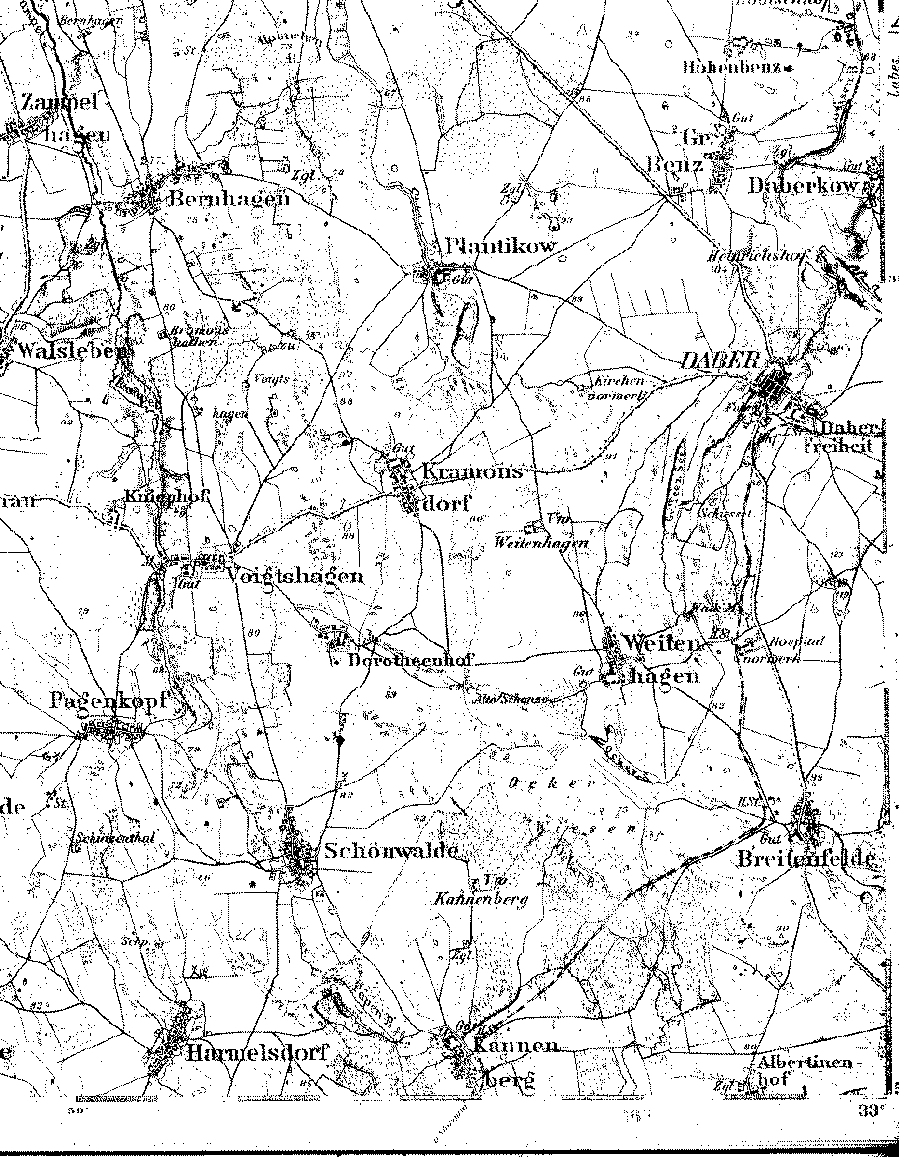
A detailed 1893 map showing part of the county of Naugard, Pomerania. [map covers an area of about 7 x 9 miles.]
Note: The longitude on this map is based on the Ferro Meridian. Subtract 17° 40' to convert to Greenwich.
From the Library of Congress collection of historic 1:100,000 scale topographic maps of Germany. Karte des Deutschen Reiches, Reichsamt fur Landesaufnahme, [Berlin.]
| Map to the west | Map to the east | Map to the north | Map to the south |
| A 1:350,000 scale map | Back to Pomerania | Table of Contents | Home |